


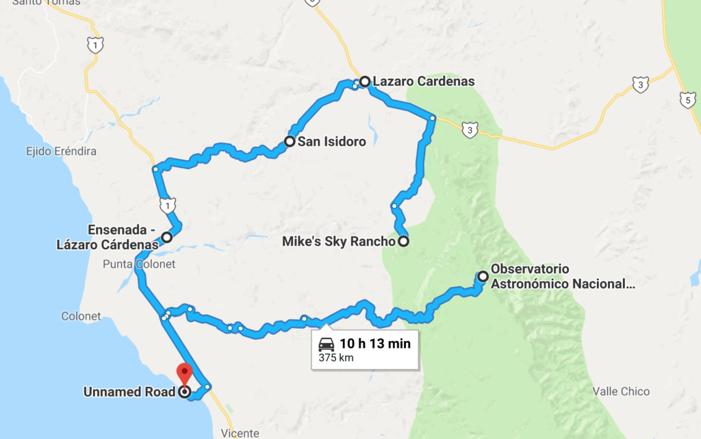
The Road from Mike’s Sky Rancho
I had a pretty good night’s sleep at Big Mike’s Sky Rancho . I went outside once and it was bitterly cold. When I got up the next morning to go to breakfast, I bundled up, went outside, and it was already t-shirt weather at 8am. Amazing. I realized how beautiful the resort is.
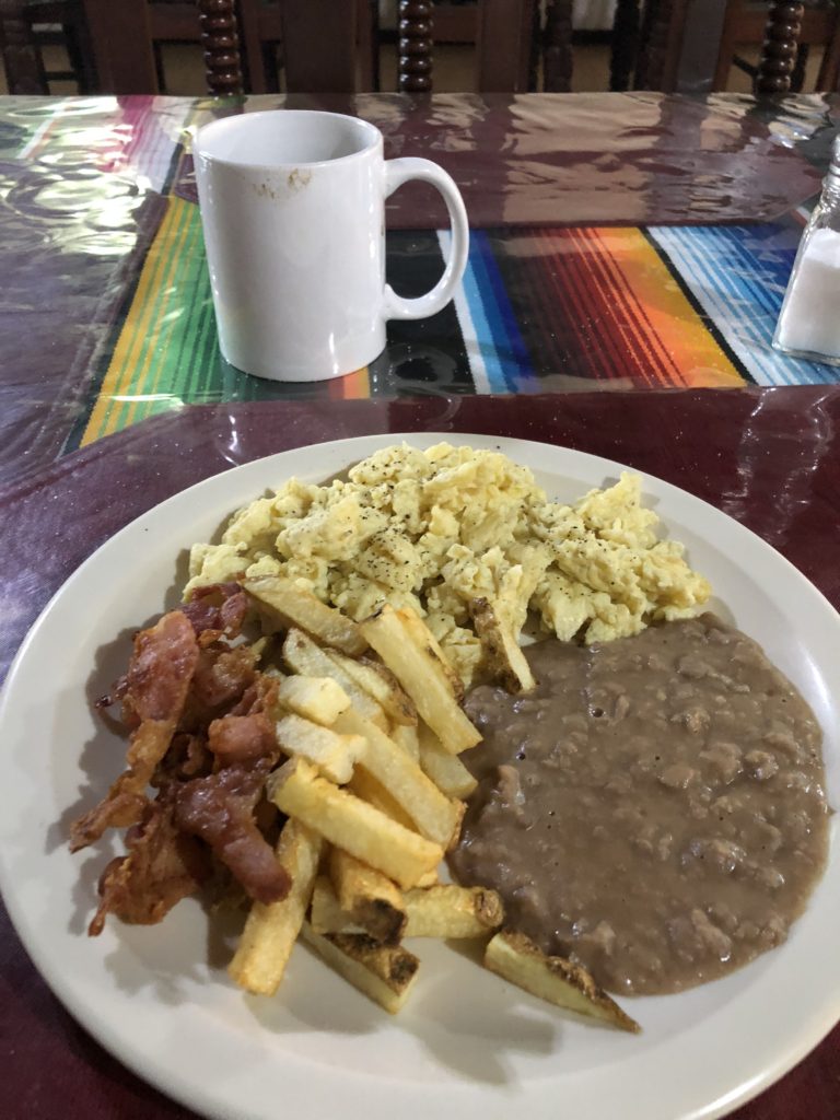
I was afraid they were going to hand me a gigantic plate of eggs, bacon, and potatoes. But the portions were very reasonable – which was nice – as I was still quite lleno (full) from the night before.
I said my goodbyes and after a false start in the wrong direction – headed down the road to El Coyote.
I have one thing to say about Google Maps offering up this route to unsuspecting motorists:

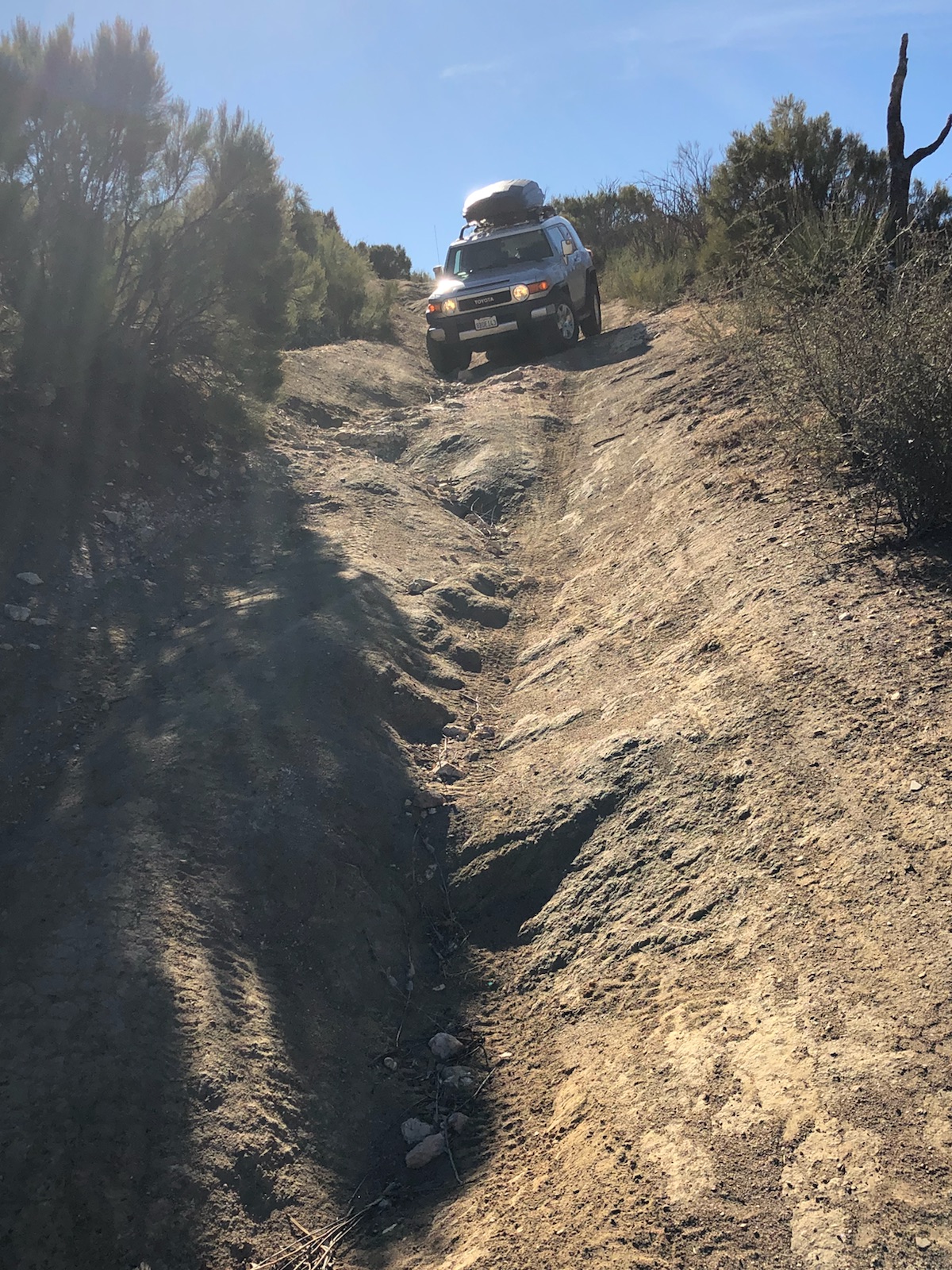
The route started out quite lovely for the first few hundred meters, then the stream crossings started, then it got hilly, then crazy.
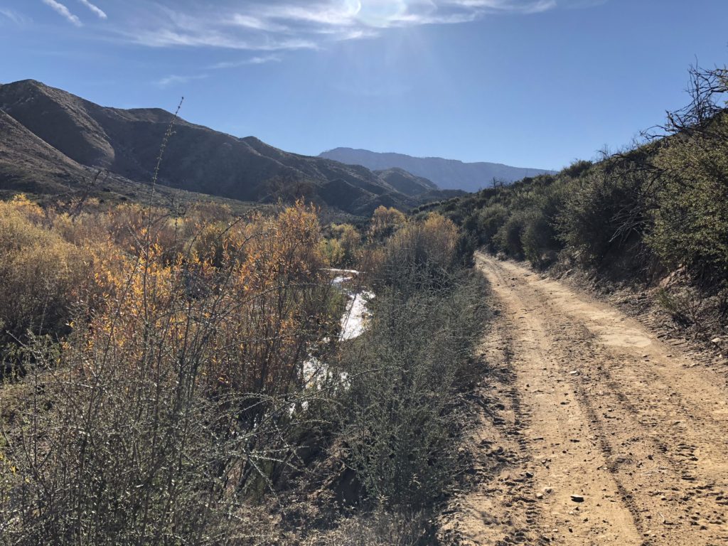
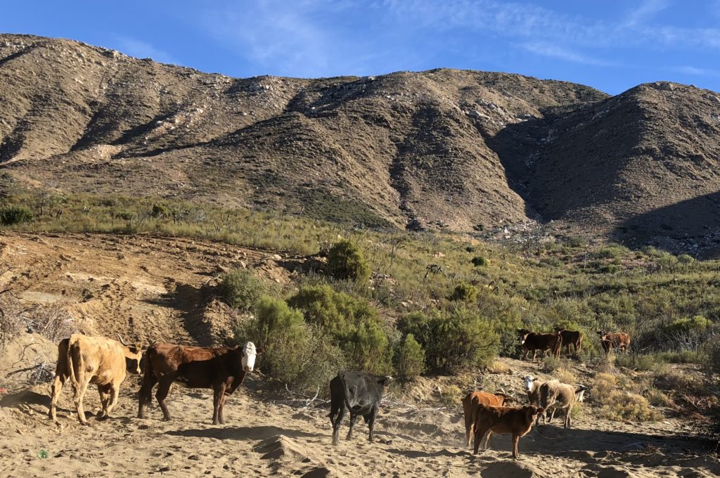
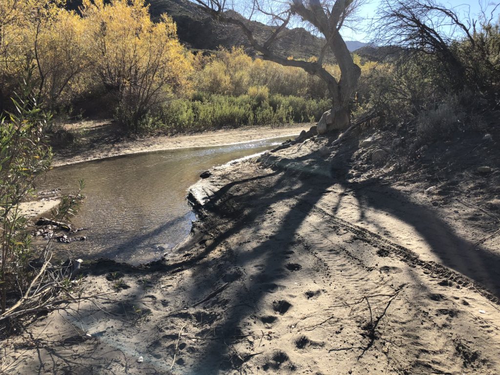
I went up and down one hill that was not quite but in the ballpark of the hairiest thing I’ve ever been on with my FJ. And those other times I was either with people (near Glacier NP), or knew people weren’t too far off (in Mohave Preserve) and I had my super-premium triple AAA to bail me out when I could get to a phone. As soon as I got to the bottom of that I saw another hill that looked just as bad. I looked down and I had gone 1km out of about 22km of the solid grey road on my map. There’s even a class below that which is dashed grey road that can’t possibly even be a road.
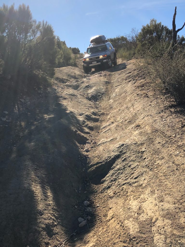
Anyway I started thinking about what would happen if I punctured my oil pan or bent a torsion bar or something out here. I should have gotten some skid plates before the trip. I wonder if I can get them along the way somewhere?
I’d have to walk back to Big Mike’s and who knows what after that. It’s not exactly the kind of place you can tow someone out of. So they’d probably have to try to fix it on the spot. Most serious 4-wheelers have the ability to fix stuff and even weld on the spot. Also a winch.
Also what if I was close to El Coyote when it happened? Should I go there or back to Big Mike’s? The decision would be a little easier if I had any idea what El Coyote is. If it’s a town it’s a tiny one. Would I be knocking on doors with my crappy Spanish? Also what if I somehow roll my car out here and my trip dies before it even began?
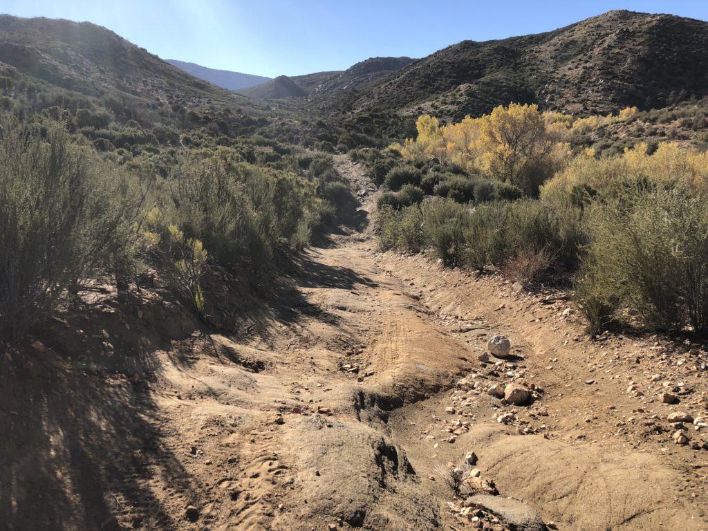
So long story short I decided that alone, in Mexico, w/o cel coverage, much tools or a real winch – to just call it and turn around. I ended up taking a different scenic dirt road shortcut (video below), this time a red road on the map, not gray. All told, wussing out on the road to El Coyote added about 3 hours out of the way to skip 22km.
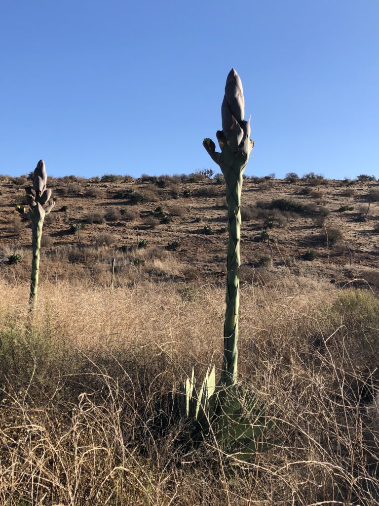
These crazy Star Trek-looking agaves were on the way into the park:
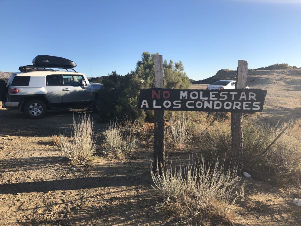
Close to the entrance of the park – there is a spot where apparently California condors always congregate – because there is a permanent sing warning you not to molest them (tempting). I had no idea California condors were in Baja. It was pretty amazing to see them from a few feet away. Hopefully Mexico has more sense than the US – and they ban lead ammo so they can try to make a come back.
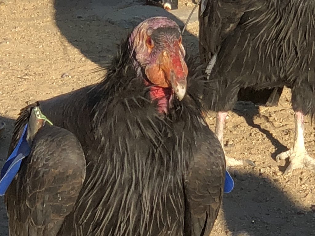
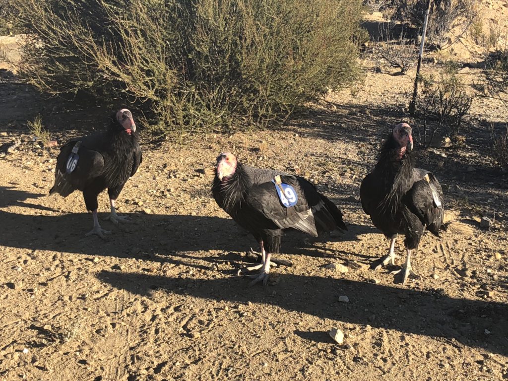
Apparently feeding them jerky does not count as molesting.
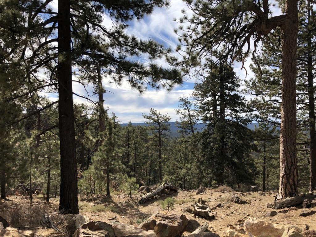
Sierra de San Pedro Mártir
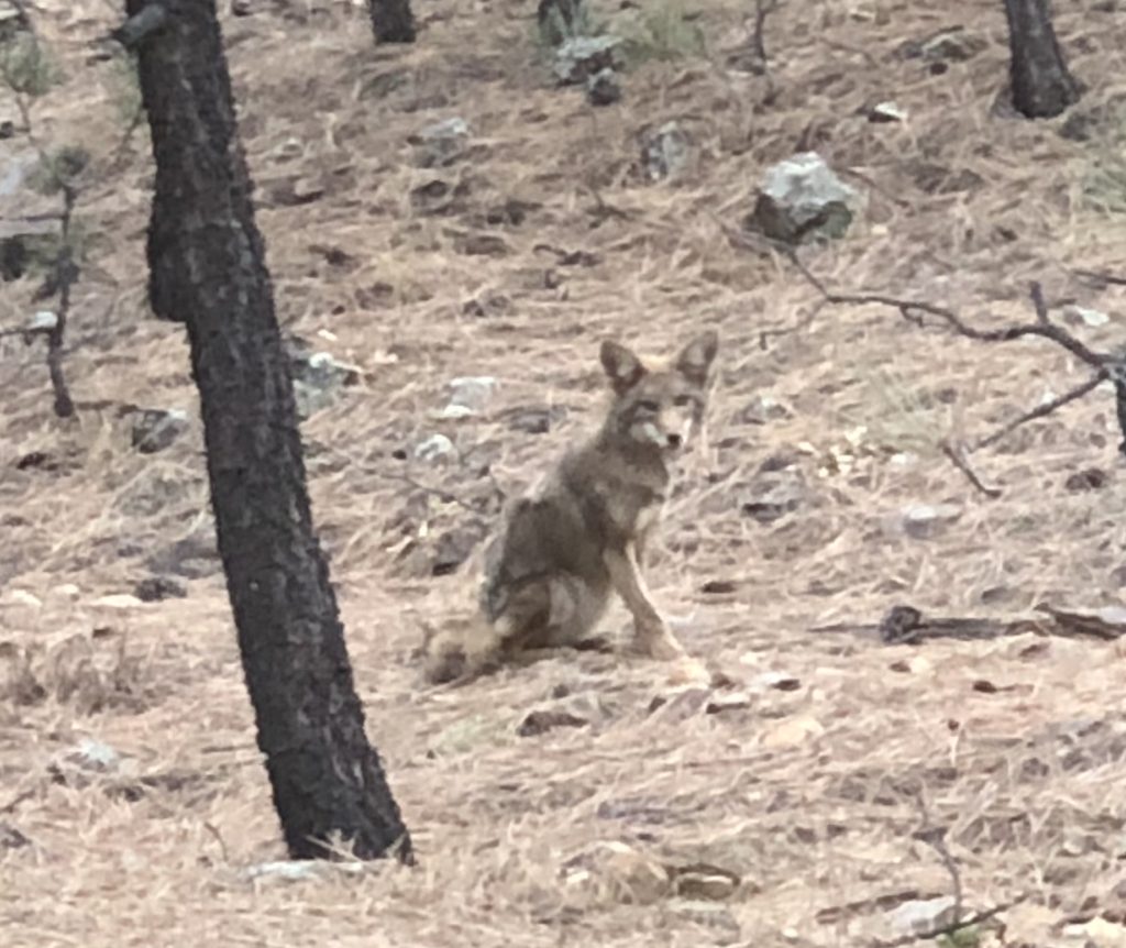
I made it into Sierre de San Pedro Mortir about 4pm, got a camping spot. And here I sit listening to coyotes go crazy a few hundred feet from my tent.
I may actually try the road again tomorrow from the other direction. It’s in the direction I want to go – AND I left my blanket I just bought at Big Mike’s – argh! If I can get to within 1km of Big Mike’s I know I can handle the rest.
[Post-edit: when I left the blanket I figured – if anything will be easy enough to replace in Mexico – it’s one of those tourist blankets that you can buy in dozens of shops in Tijuana, or they will literally come up to your car and sell you as you wait in line to get back across the border. (Pro tip: you can also buy them on Alvarado St. in LA and save the long drive.) However something in the back of my mind said that I might have a hard time since they only appear in shops that cater to tourists. Sure enough I tried a half-dozen places along the way south, and not only did they not have them, all of the words I could pull up with my various translate apps just elicited blank stares: manta, frazado, cobija. Nada. I finally pulled up a picture and they said “Oh serape! Uh no, no tenemos eso.” Apparently Mexicans don’t actually use blankets, they just make them and sell them to tourists. I did finally find another, which will appear in a later post.]
[Post-post-edit: turns out a serape is a thin blanket that’s meant to be worn, not used as bedding. The blankets I was looking for are called cobija but I was probably saying it wrong]
[Post-post-post-edit: the town I am in now, San Miguel de Allende, claims to have invented the serape]
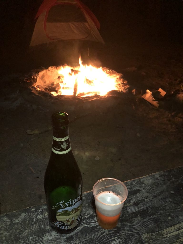
The last of my US beer. In retrospect I probably should have saved this and drank it in Ushuaia. But that didn’t occur to me until a few days later. So I will have to drink a sugar-free Red Bull that I brought from LA instead.
I got up about 9am because it was cold outside dammit. Sure I could get up at 7, or at 8. But the sleeping bag is warm. A big reason I go on organized photo trips is to have peer pressure force me to take get up at 4am to go take pictures of a sunrise. I can on rare occasions get up all by myself and hike 3 hours in cold darkness to shoot a sunrise somewhere. But it pretty much uses up all my willpower for the rest of the day.
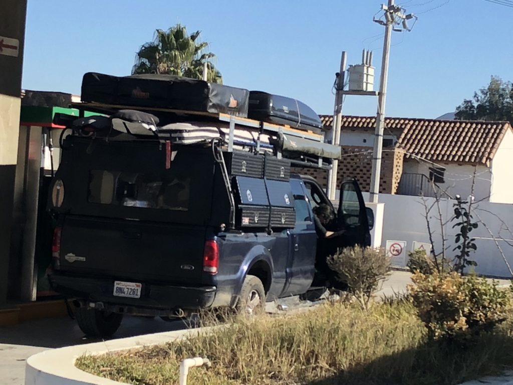
I really felt like biscuits and gravy (REI freeze dried boil-in-bag – which will be known as ‘REI rations’ for the remainder of this blog). But I sure haven’t earned a 2-meal serving. So I ate half with the idea to eat the other half during my hike later. Then I decided to get organized, now that I have the roof top container. I pulled everything out and tried to decide if it’s not something I access often – meaning it should go up top. It took a couple hours and felt like a mini-version of packing for this trip. But when it was all done I felt a lot better.
I went for my hike and managed to get some exercise, but nothing like the training I need.
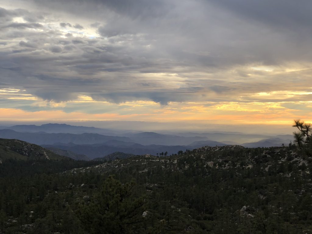
It was also a little spooky because there was no one else around – Christmas day the park was packed, the next day it was almost empty. And the forest was pretty, but basically featureless rolling hills with cypress trees.
Beautiful – but no real landmarks to orient yourself by. I was following an old road, but still the thought of getting lost out there spooked me, as I had no bearings and I hadn’t loaded a topo map on my phone. Sometimes the trail or road meets up with another and you don’t notice, then on the way back you have a fork in the road to decide over. So I was relieved that the road never gave me any hard decisions. I made it back to my car and had the cold biscuits and gravy-flavored goo that was left in the bag.
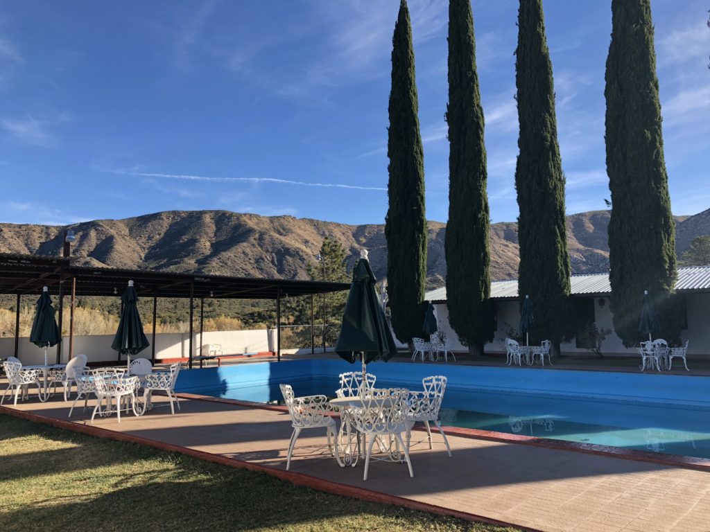
I made it down to the main highway by just a little after dark. I decided to check out the hotel I had seen just up the road. It was open and only $350 pesos ($17). Nice enough and good wifi. They were trying to do some kind of fancy desert southwest vibe with the hotel. It didn’t work at all. But I appreciated the effort.
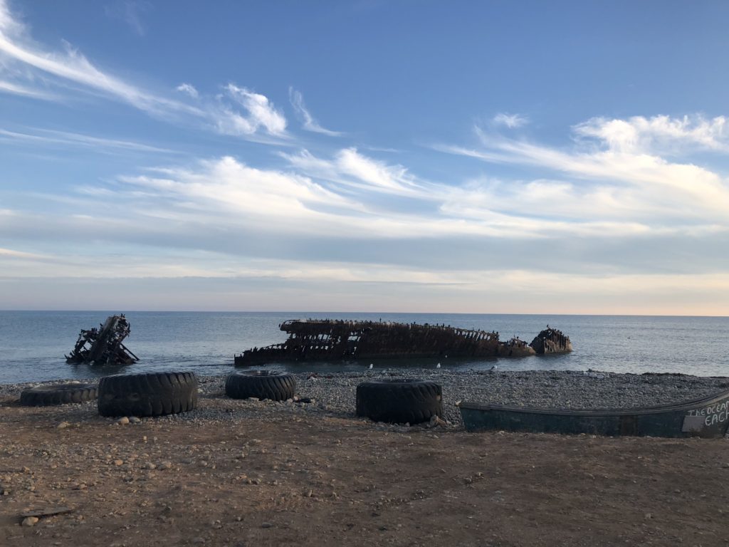
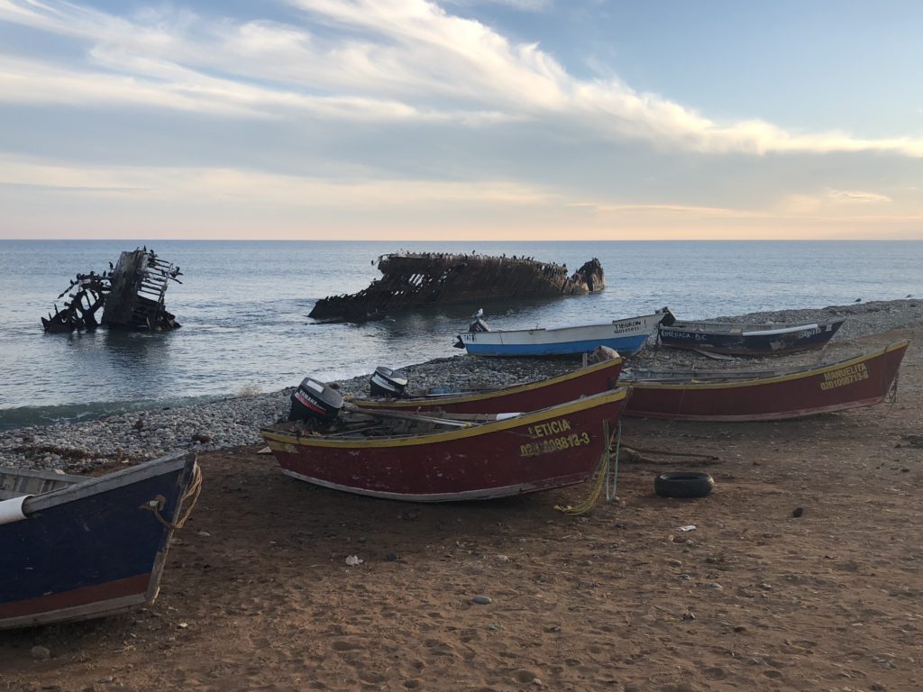
I got a text from the Canadian couple. They were camped just south of me at a surf spot called Shipwrecks (also called Punta San Jacinto). I decided to go down and see them the next morning.
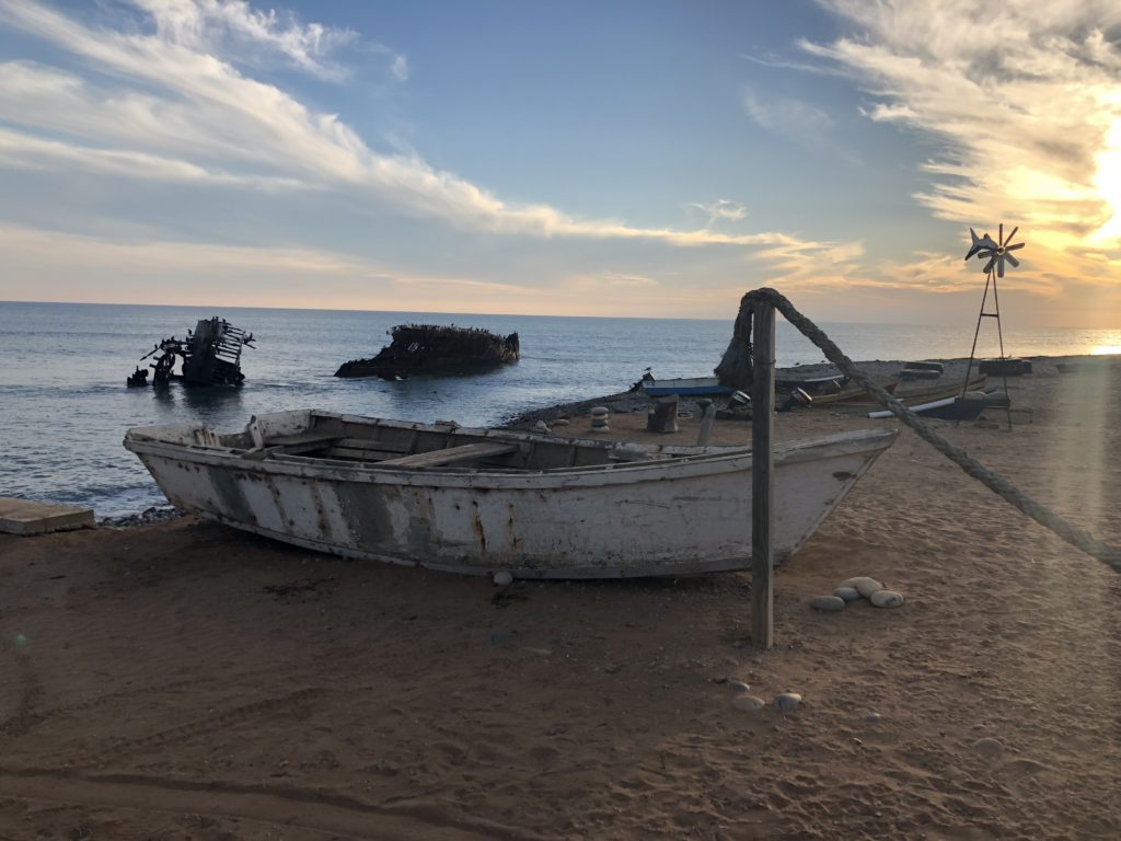
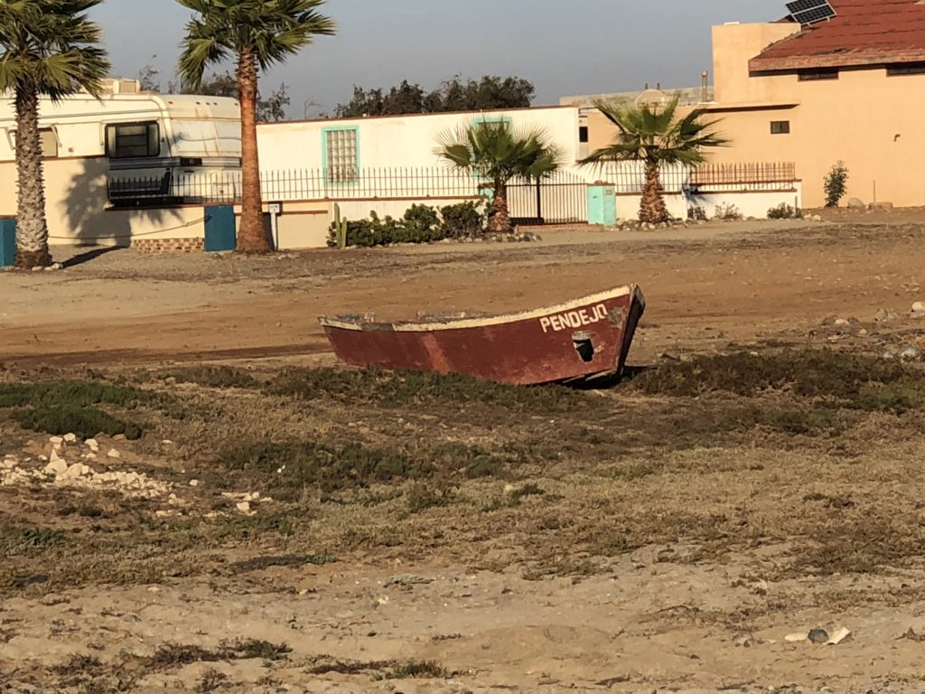
Punta San Jacinto (aka Shipwrecks)
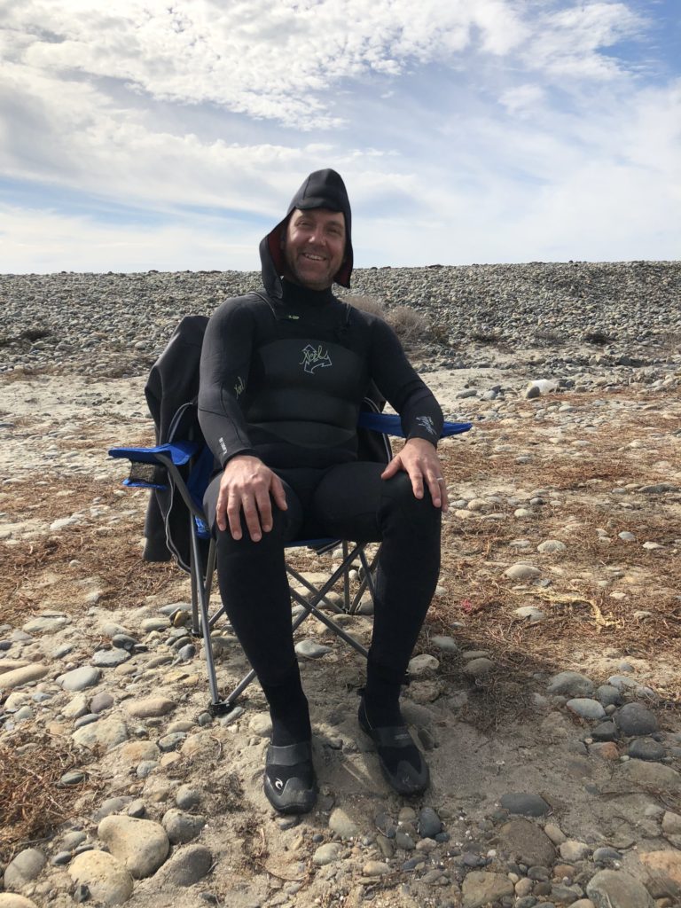
Punta San Jacinto is a fenced in compound of a couple dozen houses in various states of construction, and a place for beach camping for $5/night. I saw Mike and Kelley’s van at the end of the beach. We talked a bit and I decided to camp there that night, then we would caravan down south the next day.
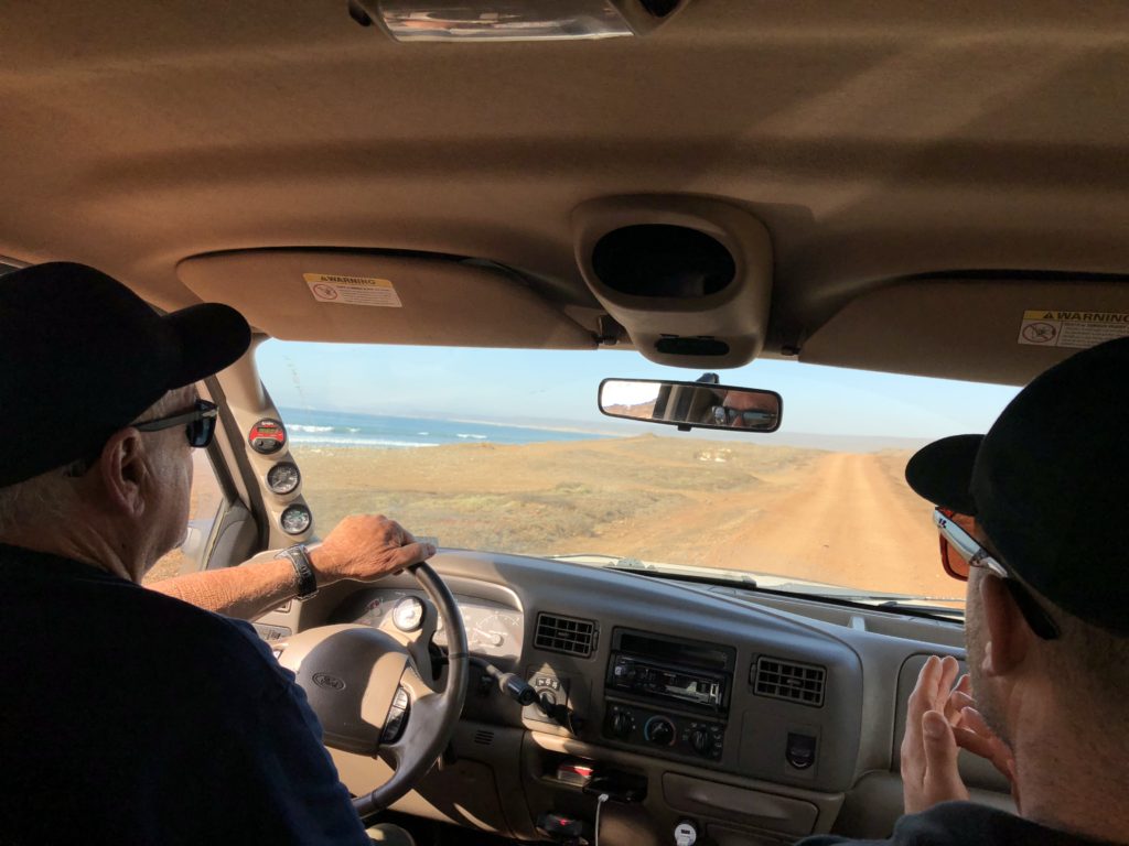
Not too long after Mike got back from surfing a big double cab ford truck pulled up. Enter Crazy Dale. Dale took Mike and I for a ride around the area – checking surf breaks and giving us the low down.
Dale owns some property in Punta San Jacinto and comes down from San Diego “Whenever the bullshit just gets too much to deal with back home.” He informed us that he’s been married 45 years and his wife “doesn’t give a fuck” what he does. I got the impression Dale was already well into a few drinks at 11am. Although he did tell us “I never fucking drink in the states. Just down here then I fucking let it all go.” Good to know.
But Dale did provide a ton of interesting information. The biggest thing I took away was that pretty much all of the crime was just petty crime – mostly perpetrated on people who were too cheap to pay the $5 and camped outside the compound – then made a lot of noise then got their camps raided when they passed out drunk. Oh yeah – and just off the road looks like dry dirt but it’s actually salt mud with a light coating of dirt – that you will quickly sink in to your axle and take a tractor to pull you out. And even after that the salt mud will corrode everything on your car if you don’t wash it off right away. Also good stuff to know. Dale invited us to come by any time after dark if the fire is going.
Later we went for a walk up and down the beach and saw Dale getting the fire going, with a few other people hanging out drinking.
Some of the lots just had collections of trailers on them. Some at the very end were built up into two story houses and seemed to be the nice end of town. Also the beach path gets very narrow down there so you’re almost walking through people’s yards. And the first of the country club houses had a very yappy dog. It all seemed designed to convince the riff-raff to turn around, which we did.
After the walk, we had a couple of beers and decided to go down to say hi to Crazy Dale. We stopped by the camp next to us – 3 cars of younger surfers – and talked to them for a bit. Told them to come by Dale’s later if they feel like getting rowdy (just a hunch plus it sounded cool to be able to invite people to a big party). We started to head over to Dale’s – but first we had to backtrack and gather 5 of us to push some French guy in a van out of a very small patch of sand that he had managed to get stuck into. The next day the dude flew a drone to wake us up, then snuck out w/o paying his $5. Lame.
So we show up at Dale’s and it’s a RAGER. And by rager – I mean Dale playing guitar and singing the first 1/3rd of a wide variety of songs, while his son-in-law struggles to retain consciousness. However Dale was pretty good and I was very impressed with his song selection – everything from some obscure folk singers I never heard of to AC/DC to 867-5309.
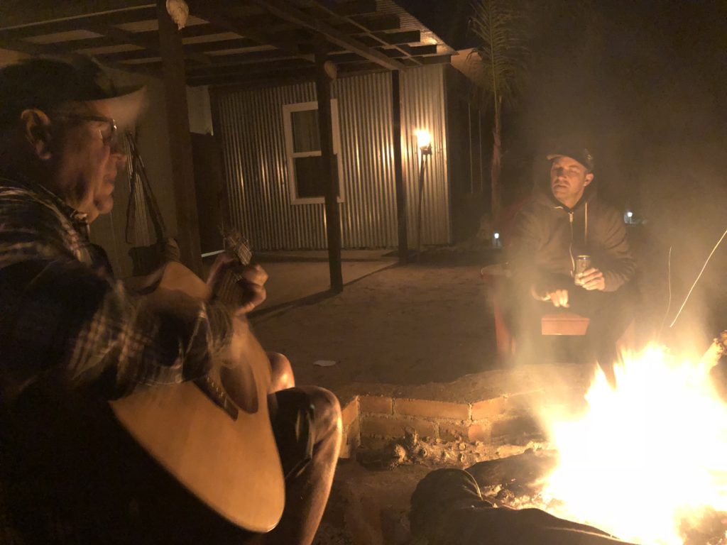
We lasted about 45 minutes. I kept worrying the surfer kids would actually show up. But luckily that never happened. On the way back the weirdest pea soup fog set in. Some people were shining one of those super-powerful military flashlights. It looked like a Hollywood spotlight in the fog. I need to get one of those. You could literally use it to blind an attacker and get away at night.
I stopped off at the surfer kids’ (for the purpose of this blog, “kid” = probably 20s, definitely younger than 35) camp on the way back to warn them that they probably wouldn’t want to head down to Dale’s off-the-hook fiesta. They made it clear they had no intention of going anyway. I’m probably their Crazy Dale.
I hung out and had a beer until they started talking technical surf jargon and I was completely lost for about 5 minutes. It’s always interesting to realize how much time and thought goes into a hobby like that, when from the outside your first impression is that the thinking doesn’t extend much beyond “find a wave and jump on it dude”. I find that I can consciously know the hobby/sport/whatever must be more complicated, but somehow I still assume it’s not – until I have that eye-opening moment. Must be some strong pull in human nature that we want to believe things are more simple than they really are.
On the road from Shipwrecks
The next day we packed up and headed south. I got to do laundry for the first time in Mexico – not w/o a lot of help from the local attendant who realized I was completely clueless and basically did everything for me except load the clothes. We went back to my favorite store – Auto Zone – for some locking washers to (hopefully) keep the binding screws on the slats of my roof rack from coming loose every few days.
We made sure to fill up in El Rosario as we the next stretch of road is known as the “gas desert”. It ends up being about 190 miles with no gas, which even my crappy gas mileage and 15 gallon tank can handle. But you never know when a station is going to be out of gas, and then you have to end up buying dodgy gas from someone selling it out of the back of their pickup truck.
We spent the night at a place called Campo Santa Ynes (or Santa Ines depending on which side of the coin flip your map picked) in a tiny blip of a town called Catavina. They have camping, and possibly a room for rent, and a restaurant that was closing early because the cook wanted to go home.
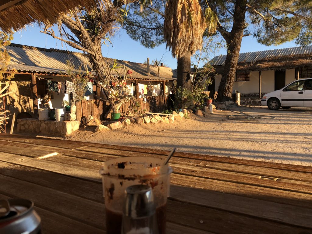
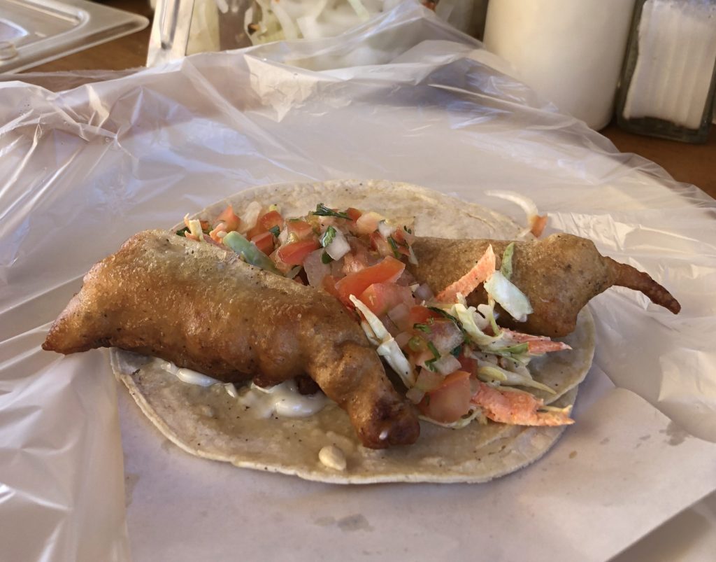
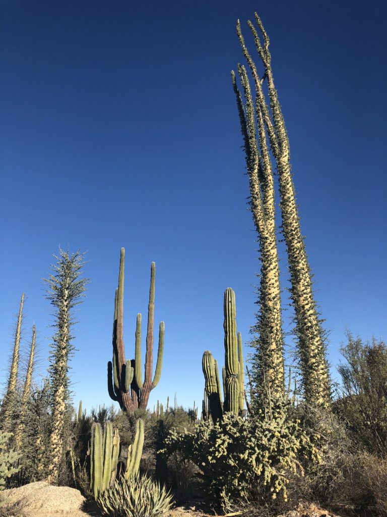
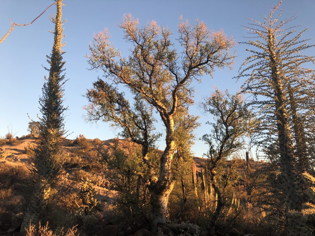
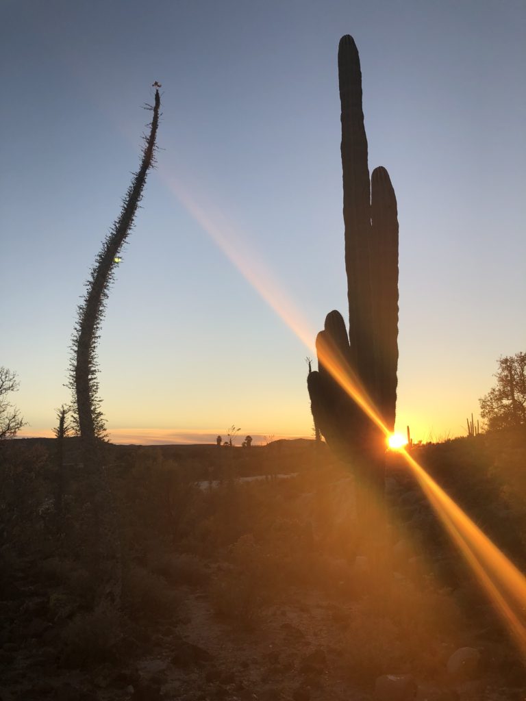
Seems like a common stopover along the way. I had a burrito that will not be making my culinary world tour video – but it filled my stomach and didn’t make me sick so I can’t complain. The highlight of the drive and camp was the foliage. I had no idea how crazy the central baja desert is. They call the desert around Tucson “the green desert” because it’s so lush and diverse – due to multiple rainy seasons. But this absolutely blows it away. They have every kind of cactus that you see in the American West, or a close cousin thereof, and then some new crazy stuff on top of that – all packed in close proximity – and going on for 100 miles.
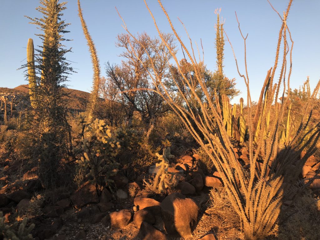
There are ocotillos, something called giant cardón (which look just like saguaros – so I call them saguaro cousins), endless variety of chollas (all evil), red barrel cactus, organ pipe cactus, two different species of “elephant trees” which look almost identical but apparently aren’t even that closely related, and the star of the show – the Suessian boojum trees – which look like a carrot that sometimes splits at the top and/or makes crazy curly cues. Driving through these things is surreal:
Catavina – Santa Ynes campo
We walked a few 100’ from camp across an arroyo (dry stream bed) into a thicket – that I honestly questioned if the diverse menagerie was intentionally planted. It looked like an arboretum except everything was packed too close together. Nature doesn’t care about room for interpretative signage apparently. I am determined to come back here and do a proper photo trip. For now I just had to sneak some shots at sunset.
Tomorrow we head south again. Whether going south or north, no one stays at this traveler rest stop in the gas desert for more than a night.
Righteous! Looks like a rad journey so far.
Happy New Year, buddy.
I forgot to send u my annual holiday letter.
Look for it in your email very soon.
?
Happy New Year Matt!
Your adventure looks awesome! Great pics! keep em coming!
Holy Cow Matt! What an adventure so far! Your commentary and photos are terrific. You’ve already packed more incredible new experiences in a few days than most people have in years. I do get the willies when you’re way off in the boonies careening along on something only map-pretending to be a drive-able road. But I’m encouraged that you have the good survival instinct to turn around before your whole vehicle plunges into the pothole from hell : ) All in all, absolutely great stuff. And by sharing it so well, you widen and enrich my world. Rock on!
Hey there. Overland Bound is down in Baja about now. You might run into them.
Next time you are at a good wifi spot, download Gaia maps. They work on Android really well and you can download them ahead of time.
I use google maps for pavement and Gaia for more of the trails. Granted, I haven’t tried it outside of the States yet, but hopefully that will change soon.
https://www.gaiagps.com/
If you get the chance, go check out The Hotel California in Todos Santos. It’s on the Pacific side of Baja. It’s a cool sleepy little town.
Thanks a lot. Yeah I plan to spend a few nights in Todos – probably camping with my BC friends. I will check out Hotel California and the town for sure. I use Gaia as well. But you have to remember to load the right maps before you get out of cel range. I loaded a map for the big mountain – Picacho del Diablo – but not the part of the park I was hiking in. It was frustrating because I could see detailed topo just a mile or so away.
Love your blog, Matt. Reading it is the most adventure I’ve had in a long time. Please stay safe, you can have a great adventure without taking chances.
Word!
I’m watching you Matt.
Dave Fisher